Hi all,
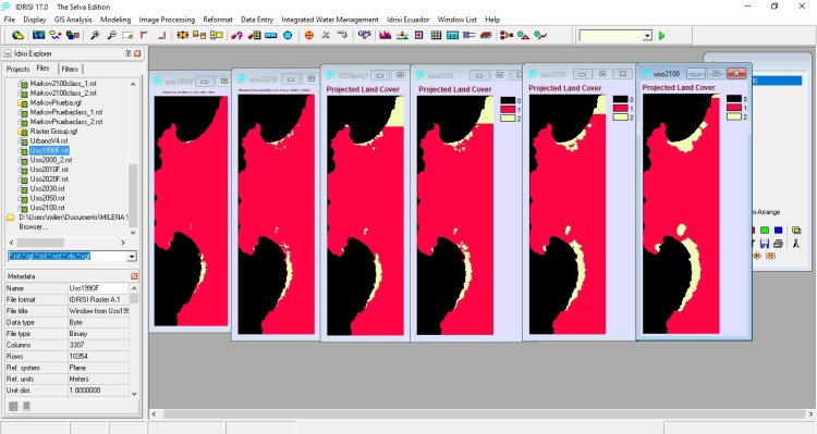
I have a land-use classification in Idrisi selva for 1990, 2000, 2010, and 2020. 0 is the sea, 1 is desert, and 2 is urban. However, when I make the CA_Markov projections for 2020, 2030, 2050, and 2100 (I do 2020 as a control). An area in classification 2 urban appears in the map's north as an arbitrary line. Can anyone help me?